|
|
 |
||||
|
|
|
|
|
|
|
|
This material is based upon work
supported by the National Science Foundation under Grant No. 0082817 |
|||||
|
|
|
||||
|
|
|
|
|
|
|
|
This material is based upon work
supported by the National Science Foundation under Grant No. 0082817 |
|||||
 |
|
|
|
|
Show land surface temperature at 5/4/2003 and 3/1/2003 along with current weather conditions. |
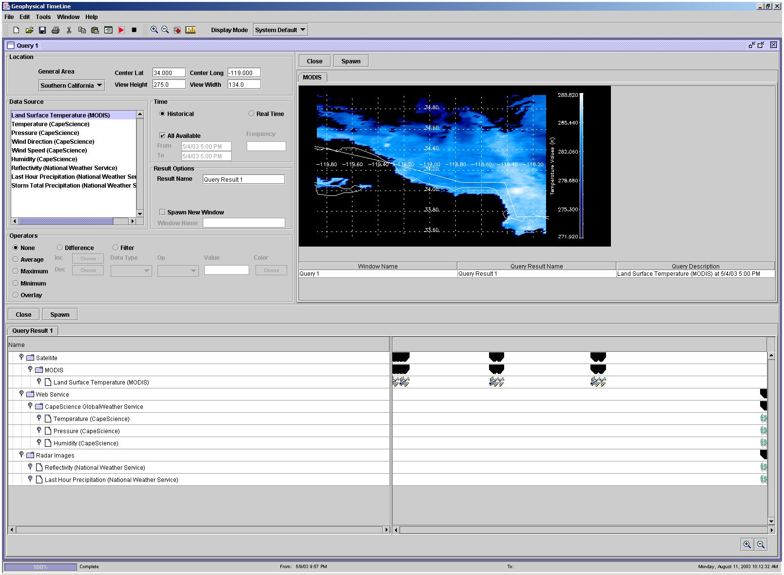
| 1. Show land surface temperature on 5/4/2003 5:00 PM overlaid on a grid. |
|
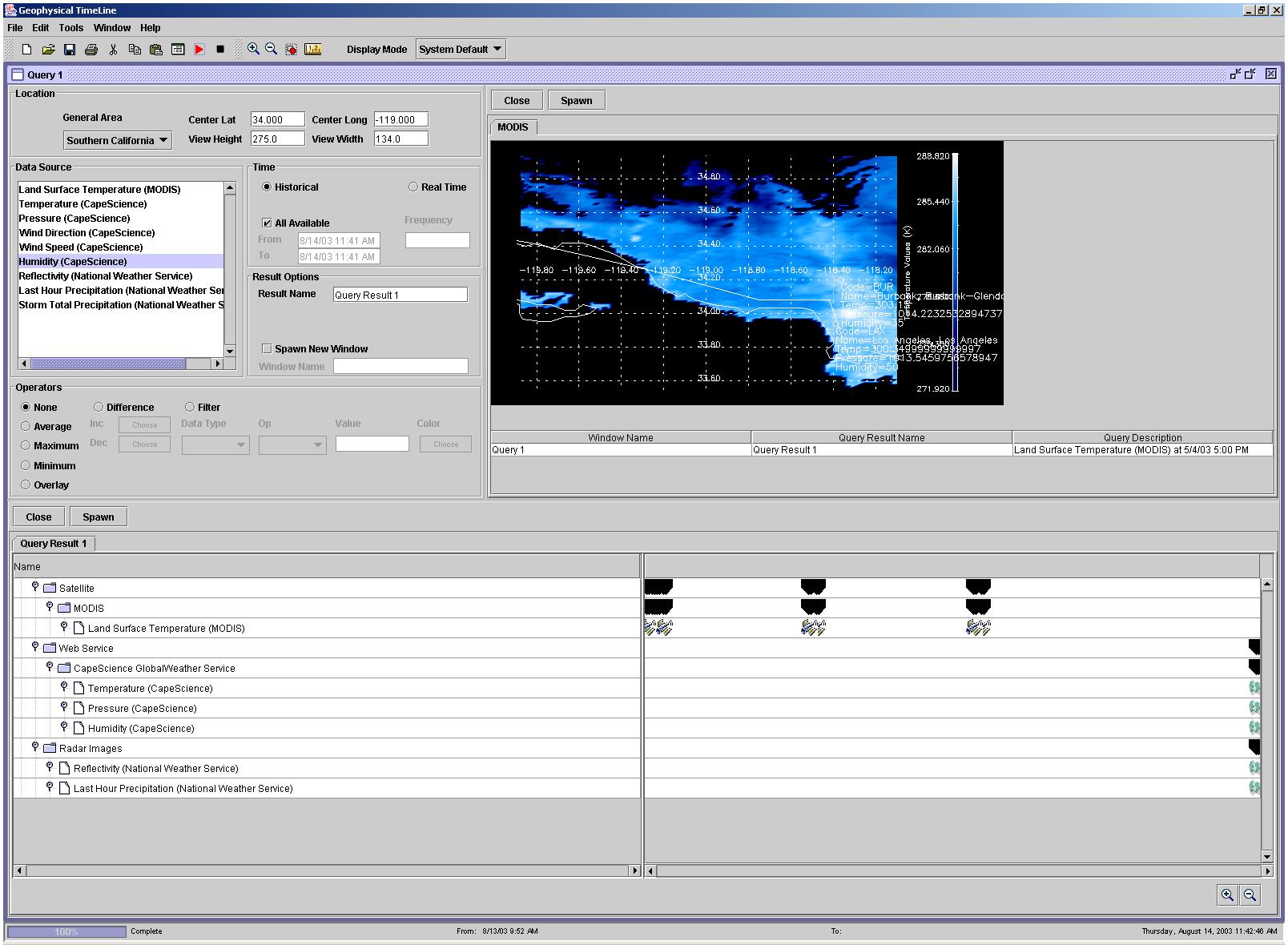
An image of a MODIS LST (land surface temperature) data instance on 5/4/2003 5:00PM is selected and displayed with continental coastline and longitude/latitude information. The data is displayed using a gradient of blue signifying the temperatures. The color bar on the right of the image denotes the temperature that the color represents. The Window Name, Result Name, and Query Description are displayed in a tabular format under the image. |
 |
|
|
|
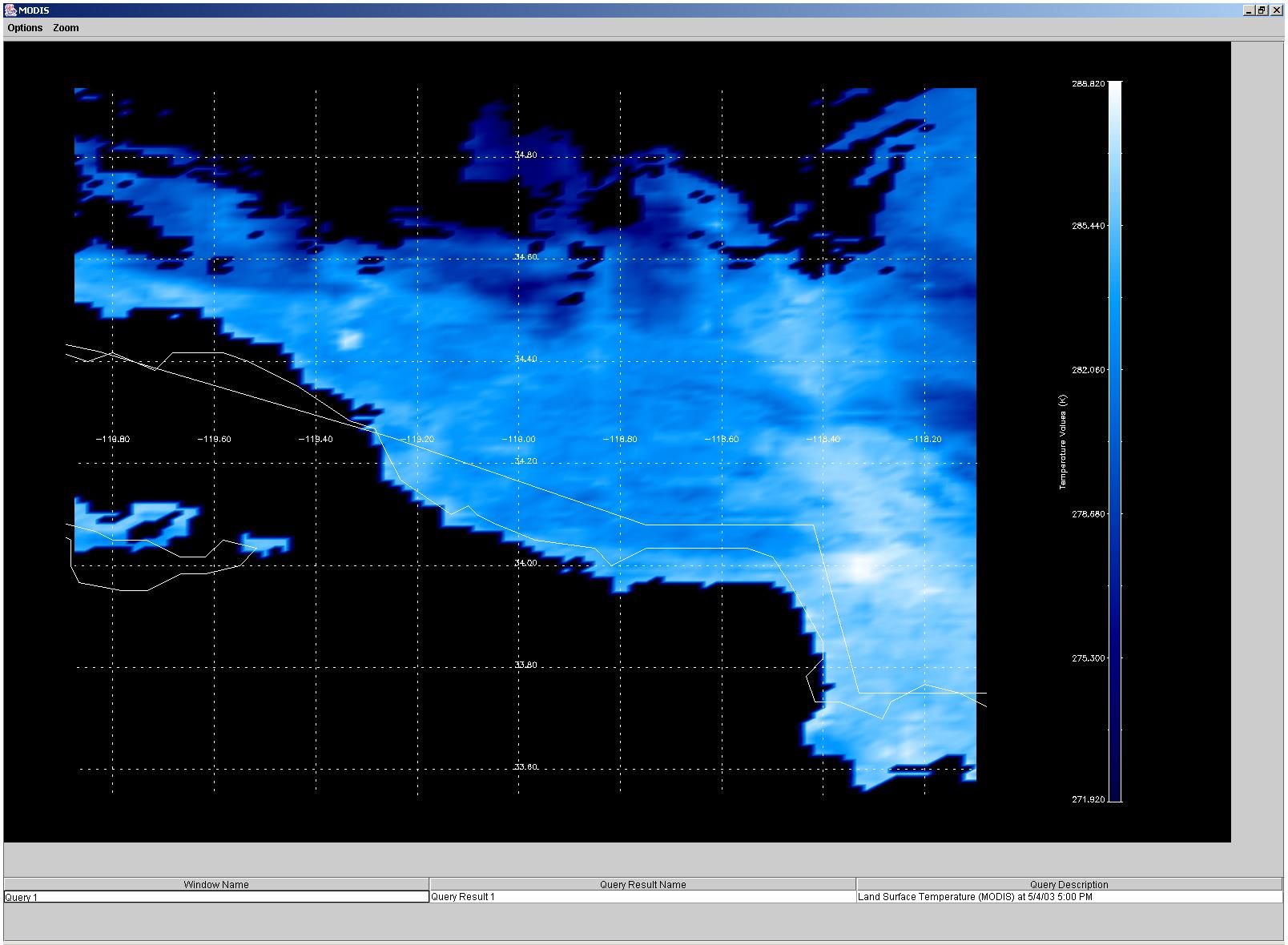
A window of the display image is spawned and the image is zoomed-in appropriately. |
 |
|
|
|
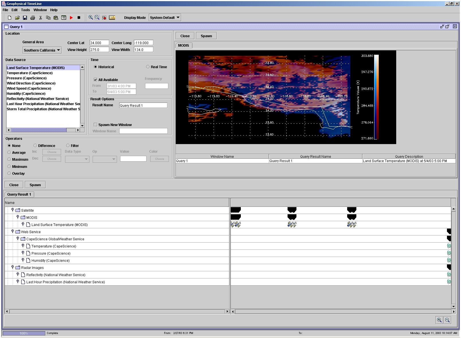
2. Show land surface temperature on 3/1/2003 4:00 PM along with land surface temperature from 5/4/2003 5:00 PM. |
|
Another image of a MODIS LST (land surface temperature) data instance on 3/1/2003 4:00PM is selected and displayed, overlaid on top of the previous selected MODIS LST data instance from 5/4/2003 5:00PM. The current data instance is displayed using a gradient of orange signifying the temperatures. Again, a color bar on the right of the image denotes the temperatures that each color represents. |
 |
|
|
|
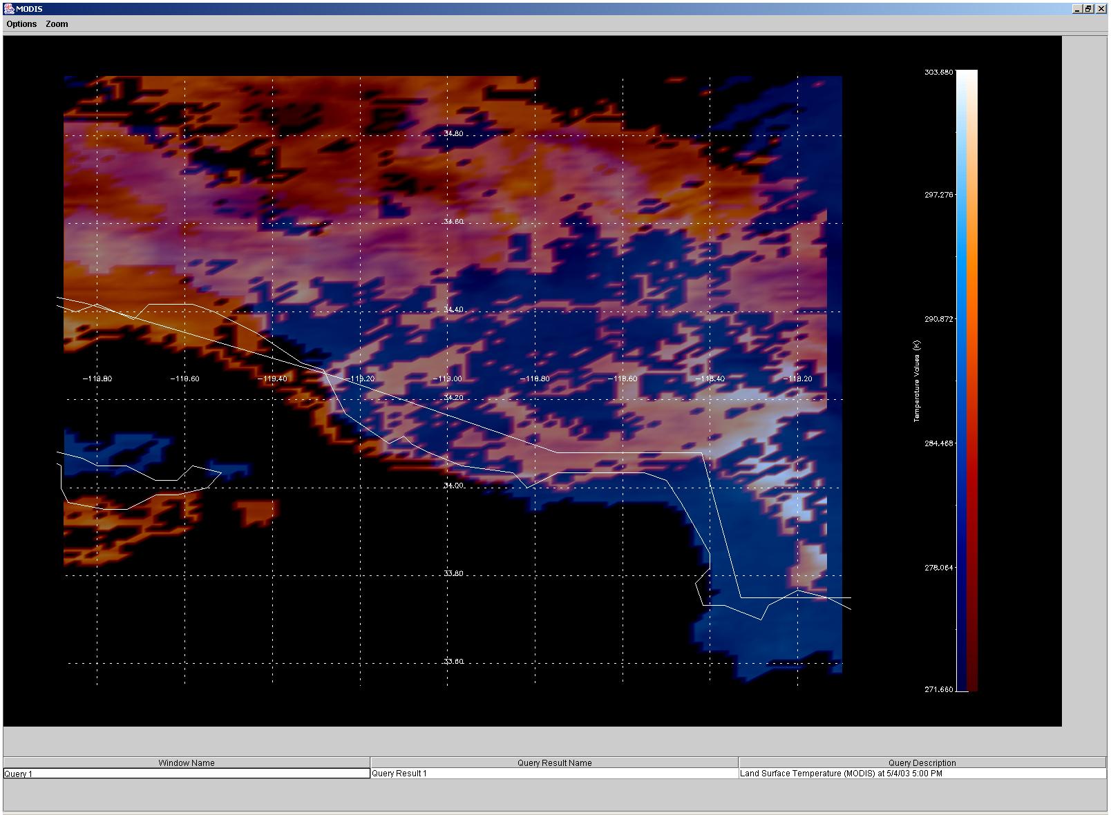
A window of the display image is spawned and the image is zoomed-in appropriately. |
 |
|
|
|
3. Show land surface temperature on 5/4/2003 5:00 PM along with current weather conditions for Burbank Airport and Los Angeles International airport. |
|
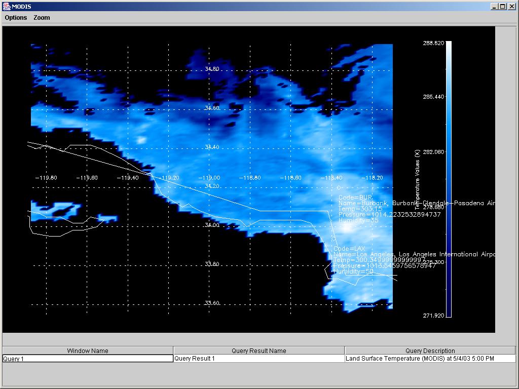
An image of a MODIS LST (land surface temperature) data instance on 5/4/2003 5:00PM is selected and displayed. Two Southern California airport information is also retrieved using the CapeScience GlobalWeather web service, and overlaid on top of the MODIS LST data. |
 |
|
|
|
A window of the image of MODIS LST data overlaid with the airport data is spawned and the image is zoomed-in appropriately. Note the displayed text. |
 |
|
|
|
4. Show land surface temperature on 5/4/2003 5:00 PM along with land surface temperature on 3/1/2003 at 4:00 PM and current weather conditions for Burbank Airport and Los Angeles International airport. |
|
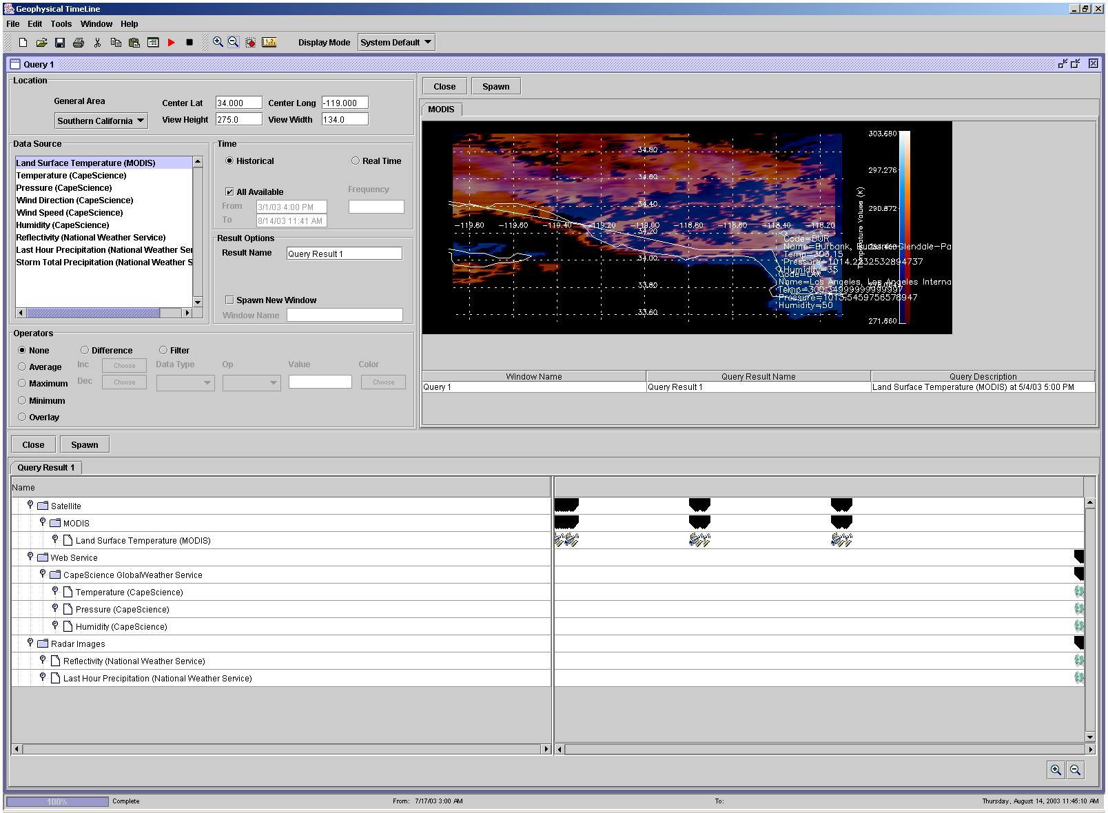
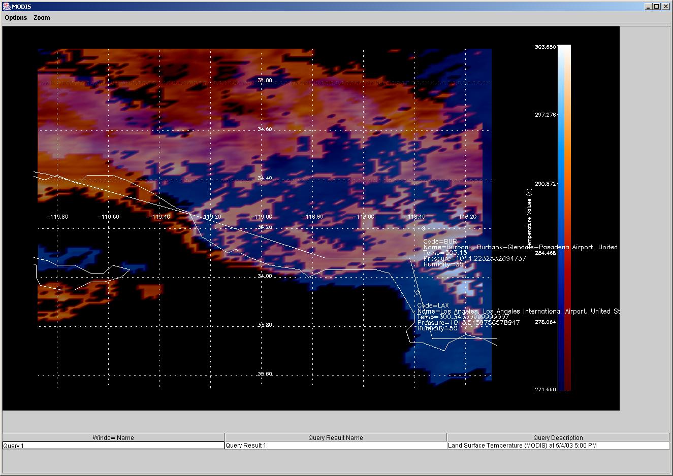
A data set of a MODIS LST (land surface temperature) data instance on 5/4/2003 5:00PM and a data set of a MODIS LST data instance on 3/1/2003 at 4:00PM are selected and displayed. Two Southern California airport information is also retrieved using the CapeScience GlobalWeather web service, and overlaid on top of the MODIS LST data. |
 |
|
|
|
A window of the image of MODIS LST data overlaid with the airport data is spawned and the image is zoomed-in appropriately. |
 |
|
|
|
| Any opinions, findings, and conclusions or recommendations expressed in this material are those of the author(s) and do not necessarily reflect the views of the National Science Foundation. | |